McCargoe Cove Documentation and Survey Project.
August 1 - 5, 2012
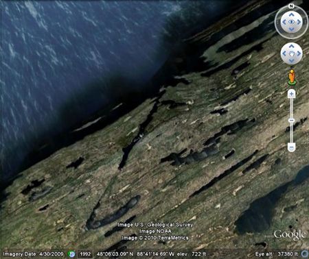
Satellite Picture of McCargoe Cove
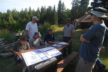
Mapping the Artifacts found in McCargoe Cove
Photo by Randy Beebe
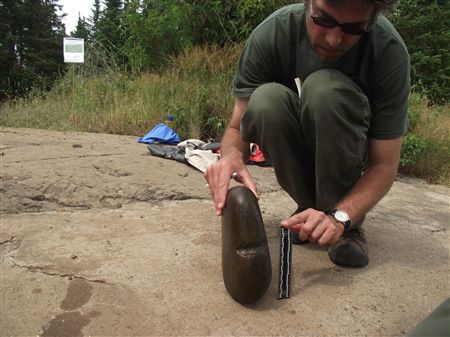
Grooved Stone Found in McCargoe Cove
Photo by Randy Beebe
For more information about the Project, please click on link button below
McCargoe Cove Survey Project - 8/1/2012
__________________________________________________________________________________
McCargoe Cove Underwater Phase I Archeological Survey
August 1 - 5, 2012
Closing Report
McCargoe Cove Survey Project; Year Two
Seven volunteer divers from the GLSPS traveled to Isle Royale National Park on August 1st to conduct an underwater Phase I archeological site survey of McCargoe Cove. This long, narrow inlet on the Island's northeast coast has a rich history of human activity dating back thousands of years. The five day trip completed a two-year project that was done in collaboration with the National Park Service under the direction of the Isle Royale Cultural Resource Manager and NEPA Specialist, Seth DePasqual. The divers on the team included Pete McConnell, Dan Lewandowski, Kelly Murphy, Jeff Pearson, Bob Nelson , and Randy Beebe. Two boats were used again this year on the project including the R/V ARCTIC FOX and the GLSPS dive boat the R/V PRESERVATION Captained by Bob Nelson.
This year, just as last, we had a great team and the overall result was a productive, informative survey as well as an exceedingly enjoyable trip to the Island. Initial feed back from the Park Service is very positive with some discussion of possible future collaborative projects both underwater and above water.
The survey fieldwork has now been completed along the length of the nearly two-mile long cove with the divers swimming along at specified contour depths while recording any items of interest with underwater photography and GPS coordinates in UTM format. This data will be recorded and organized and will be a contribution the Park Service’s understanding of our underwater cultural resources.
Overall, the project went without a hitch other than being weathered in on Amygdeloid Island for a couple of days longer than planned. This spot was a great place to be weathered in though as we explored the island and enjoyed the hospitality of the National Park Service.
Coming in November at the "Gales of November" conference in Duluth, Seth will be giving a presentation on McCargoe Cove and the survey project. I hope to see you there!
Randolph Beebe
Project Leader GLSPS