GLSPS Gooseberry Falls State Park Logging
Artifact Documentation Project
Please Click on the link below to Register for this great learning Experience
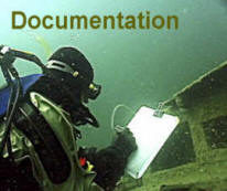 Steve Daniel Documenting a Shipwreck
 Gooseberry Picnic Area Wall
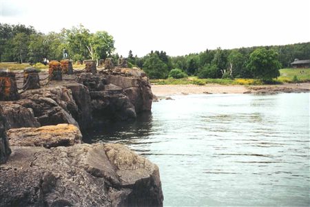
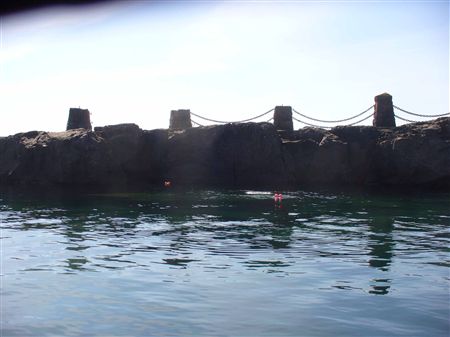
 Gooseberry River Mouth
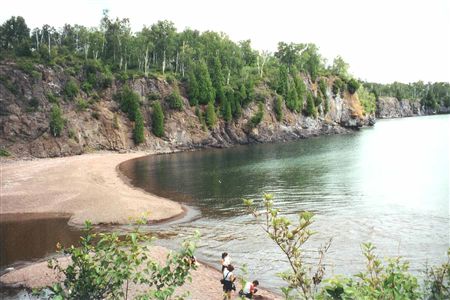
 Gooseberry River Path # 2
The GLSPS has another "Great" Project coming up.
The "Gooseberry Falls Logging Artifact Documentation Project".
If you are interested in joining the GLSPS to help document these artifacts, find out more details about the project or Register, please click on link below.
Gooseberry Falls State Park Logging Artifact Survey - 6/25/2011 . Please remember, to register, you need to log in on the GLSPS Website as a member using your user name and password.
Please take a moment to reserve a camp site early (or hotel nearby) to accommodate lodging for the Project. Please click on provided links below to Gooseberry State Park Camp Ground Reservations and Burlington Bay Camp Ground in Two Harbors.
Please Note: Gooseberry State Park Camp Ground is full. Please consider Burlington Bay Campground in Two Harbors. Call 218-834-2021 to make reservations for a campsite, if you have a trailer, etc. I will have my 22-foot Travel Trailer & Suburban on site # 47. Pete McConnell is bring his Zodiac for the Belle Cross Rudder documentation and will be on a nearby campsite. We can put a tent on each of our sites ($10 extra + $10 for another vehicle). Please call me at 651-470-5389 if you have a question. We need to lock down the list of participants so that I can shop for lunch items, as appropriate.
Gooseberry State Park Camping - Lodging Reservations
Burlington Bay Campground Two Harbors MN
Burlington Bay Campground Map
If you have any questions regarding the Project, please contact me with any of the provided information below.
Steve Daniel
Project Chairman
sdaniel@glsps.org
Cell - 651-470-5389
____________________________________________________________________________
Gooseberry Falls State Park Logging Artifact Survey
Project Details
June 25 - 26, 2011
Objective of this project (its benefit to GLSPS):
- Photograph and record measurements of historic artifacts on bottom of Lake Superior, next to rocky cliff west of river mouth.
- Locate, photograph, mark GPS and measure rudder of Belle Cross
-
Project Scope
List Individually the Project’s Requirements, Constraints & Criteria for success
- Locate and photograph various metal objects resting between rocks on bottom.
- Measure artifacts and record on paper on surfaec Mark GPS locations of artifacts, as appropriate, to define site.
- Inform state park archaeologist of findings.
- Report will be written and submitted to MHS SHPO with photographs.
-
List the Project Deliverables (expected end results)
- Marked location of artifacts.
- Images of what they look like in place on bottom.
- Sizes of the artifacts.
-
Describe the methodology to achieve the Deliverables (both proposed & alternates)
- Divers will enter from the pebble beach nearby.
- Findings will be recorded on velum taped to plastic slates.
- Pair of divers will use tape measure to gather information.
- Underwater camera will be used to photograph the artifacts.
-
Project Risk Analysis and Contingency Plans
Potential risk would be postponement or cancellation due to bad weather conditions.
An alternate weekend would need to be scheduled to complete the project.
Project Resource Requirements
Crew Requirements (list crew members, if known now)
- Steve Daniel – Leader & Diver
- Pete McConnell – Assistant Leader (Not able to go on Sept. reschedule)
- Byron Meyer - Diver
- Bill Wallace - Diver
- Helen Wright - Surface Recorder
-
Crew Skills Needed:
Certified Open Water Diver
Material Requirements:
Velum to record underwater measurements & paper to record data on shore.
Equipment Requirements:
- Dive gear
- Documentation Tools (GLSPS to provide)
- Underwater Camera (Leader to provide)
- Hand-held GPS (Leader to provide)
-
Logistical Requirements: (including R/V Preservation)
Meet in Gooseberry Falls State Park, at picnic area parking lot near dive site.
Budget Requirements: (provide separate detailed project budget)
Lunch to be provided – based on registration fees. Participants will transport themselves and their gear to project site.
Time Requirements for:
Planning: 4 hours
Project activity: 2 days
Follow-up activity: 1 day
Preparation: Coordinate tools, confirm participants, reserve campsites for leader trailer & asst. boat.
Project Execution:
Activate project on Saturday, June 25, 2011
Project Close Out:
Sunday, June 26
Describe External Funding Sources: (if available)
Registration fees. Campsite will be an individual expense.
Project Time-line (separate attachment)
Saturday & Sunday, June 25 & 26, 2011
Project Follow Up Requirements
- Write report for GLSPS & MHS SHPO.
- Write article for GLSPS Fall 2011 Newsletter
-
Please note: Persistent rain during the week before the dive, plus strong northeast winds on Lake Superior, caused brown water runoff into the Lake. this resulted in extremely poor visibility conditions that caused the project to be canceled and rescheduled for September 10, 2011.
____________________________________________________________________________
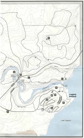
Gooseberry Logging Artifacts Survey and Documentation Project
June 25 – 26, 2011
Gooseberry Falls State Park
Background
Read pages 83 – 85 in my book, Shipwrecks Along Lake Superior’s North Shore, A Diver’s Guide. This will give you background on the two portions of our project. This project plan will be reviewed with Dave Raford, director of the State Parks Cultural Resources Program (651-259-5604). Please bring all signed GLSPS Forms from website!
Rendezvous
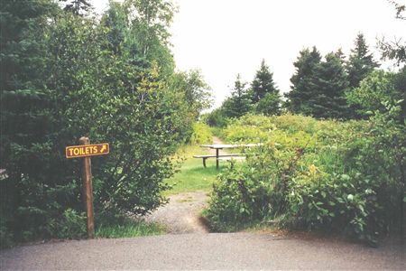
Saturday morning at 8:00 AM - Meet at Picnic parking lot near path to pebble beach alongside cliffs. There will be a “Toilets” sign near the path (see p. 85 in the book) that leads to the beach. We’ll walk the path to assess how we want to gear up (by our vehicles or on the beach). Using the beach may work best to save energy, have the tools within easy reach and have a place to have lunch. We’ll take turns diving to minimize stirring up the bottom and to have someone on the beach to record findings.
Project Plan
Saturday - we will do two dives by the small rocky cliff to document the logging artifacts.
If we have six divers, we can work in three teams. Depth is about 20 feet.
- The first team will go down and take photos of the artifacts. Steve Daniel will use his underwater camera housing and wide angle Olympus camera. His dive buddy can note the order of the artifacts on the bottom and sketch them on a slate. A quick discussion with the
- The second team, led by Pete, will go down and lay a grid on the area for reference. If time permits, they will start measuring the first group of artifacts nearest the beach.
- The third team will start measuring the next group of arti
-
The information observed will be transferred to a drawing of the dive site showing the cliffs and beach for reference.
- After lunch, the first team will determine a way using fish floats to mark the location of each item. When the float surfaces, a diver will use Steve Daniel’s handheld GPS to mark the location. The GPS may need to be placed in a small rubber dinghy, if we have a volunteer non-diver to help with this. An alternative may be to seal the GPS in a Zip Lock bag and keep it in a plastic crate lashed to the dive flag float.
- The second and third teams will continue measuring until all the artifacts are documented.
-
Sunday - We will try to locate the rudder of the Belle Cross, further down the cliffs and out into the Lake. This will be a one-tank boat dive. If a boat is not available (we won’t use the dinghy), this portion may be postponed.
- The first dive team will photograph the rudder, note its orientation to shore and tie a fish float to it, so that GPS coordinates may be recorded.
- The second dive team will measure the rudder and note characteristics of its construction.
- The third dive team will continue measuring and recording findings on plastic slates until we have the information that is needed.
-
Follow-up Activity
The following items need to be done to wrap up the project:
1. Redraw the map showing numbered locations of each of the artifacts, with a label of the item by each.
2. Create an Excel spreadsheet that will list each artifact, include its coordinates, a simple description, possibly a small photo of it and dimensions as appropriate.
3. A report will be placed on the GLSPS 2011 Projects website, along photos of the project, as appropriate.
4. An article about the project, with a photo of the participants, will be written for publishing in the Fall 2011 GLSPS Newsletter.
6/16/11 Steve Daniel, Leader (651-470-5389) & Pete McConnell, Co-leader (612-770-2547)
This Report was Updated 6-17-2011
_________________________________________________________________________________________________
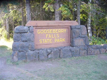
Gooseberry Falls State Park Entrance
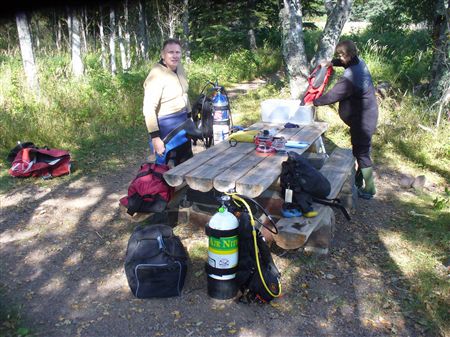
Byron Meyer and Bill Wallace Gear Up before Dive
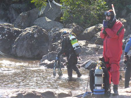
Steve Daniel & Bill Wallace ready fro Dive
Fishing Marker Buoys were used to Mark Locations of Artifacts
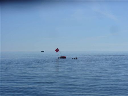
Divers Down Flag was used to mark Diver Location and store Marker Buoys
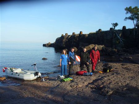
Documentation Crew - Helen Wright, Byron eyer, Steve Daniel & Bill Wallace
Gooseberry Falls Logging Artifact Documentation Project
Project Report
September 10 & 11, 2011
August 29, 2011
Sent blast email to the GLSPS Membership to invite more divers to join us in this project.
September 6, 2011
Emailed participants the registered for the Project to remind them about it and give more details for lodging and what we were going to be accomplishing on the project. Also needed to remind them to print, read and sign the Liability and Waiver Forms to bring with them on the project to hand into the Project Leader.
September 9. 2011
Email blast sent out to participants of the project on more details about what to bring where to meet and what we are doing on this project. Project crew, composed of Steve Daniel, Helen Wright, Byron Meyer and Bill Wallace, met at Burlington Bay Campground in Two Harbors to discuss the project procedure, as noted in the last email, and turn in GLSPS signed forms.
September 10, 2011
Boat Prep
Four crew were actually there, since Pete McConnell was involved in a different activity elsewhere. The crew drove to Gooseberry State Park and down to the picnic area by Lake Superior. We checked out two approaches to the stoney beach and decided on the west paved path. This led to a picnic table under a tree, just behind the pebble and sand beach area. The shade was essential during the gearing up process. Helen and Steve inflated the small rubber boat, attached a small trolling motor, oars and Diver Down Flag. Steve secured the anchor line to the anchor and boat. Helen donned her life jacket and assembled the hand held Garmin GPS in a Zip Lock Bag. She prepared the GLSPS Dive Log sheet and her chart with columns for recording each artifact found, it's description, depth and coordinates. She also placed a stage cylinder, with regulator primed, and water bottles in the boat.
Diver Prep
The divers geared up and prepared their specialized tools for the project. Steve handled the underwater wide angle lens Olympus camera. Byron placed several fish floats in the red zippered cover for the inner tube holding the Divers Down Flag he would tow. Bill clipped a dive slate, to which Helen had taped sheets of velum on each side. Bill checked the pencil lead and proceed to the beach. As the divers entered the water, Helen launched the rubber inflatable boat. The weather was outstanding - clear skies, sunny (for good light underwater) and flat seas (no wind. The visibility clarity of the water along the side of the cliff was excellent at about 20 feet.
Project Procedure - First Dive
The divers swam on the surface toward the low rocky cliff by the picnic area. Steve would locate and photograph each metal artifact as they were found. Byron would be summoned in to unwrap the lead weight and place it on the object. The marker buoy would then unwind the line and float up to the surface. As Steve and Byron moved on to the next artifact among the rocks, Bill would move in, sketch the object, take measurements and record them on the velum, as appropriate. When he was finished, Steve would surface and summon Helen to the marker. The name and brief description was given for her to record, along with the depth. This process was repeated until one of the divers needed to return to shore. An hour underwater was used to conduct this first dive. Just as the team started to swim to shore, Steve noticed that his camera flash bulkhead connector fitting had separated at a glue seam and started to leak. The camera housing was held out of the water during the swim to shore.
Surface Interval & Team Discussion
The team removed their gear and changed tanks in preparation for the second dive. The velum was also changed and a second dive slate prepared for Steve to use. The crew had lunch while resting for the next dive. Techniques were discussed and some suggestions for improvement made. The plan was working very well, with each person performing their essential task. Several hikers and other visitors stopped by to watch during the project and asked about what was being done. They seemed impressed with our efforts to document the logging history that was still present under the surface of the Big Lake.
Second Dive
The group was a little spread out, since the camera action was missing. We had agreed to have two of us (Bill and Steve) do the sketches and measuring, while Byron would locate and mark more artifacts. Helen was twice as busy on the surface with two divers relaying what was under several markers that were floating on the surface. After an hour and ten minutes, it seemed that all the significant artifacts had been noted. It was 5:00 PM and the divers were tired, so we all headed into shore. Todd Olson, who had come to Gooseberry to dive at another site, met us at the beach and helped haul gear back to the vehicles. We all appreciated his help!
Results
Over 23 artifacts were found and recorded. Some of the objects appeared to be very similar, but were different views (i.e., an identical object would be found nearby turned upside down). There were also numerous railroad rails, so not all were noted. A spreadsheet will be prepared and shared with the DNR archaeologist and MHS SHPO. This will not be posted on this GLSPS website. An example of the artifacts that were found are:
-
-
Narrow gauge railroad rails
-
Flat 3" wide metal strap with bolt holes (possibly a rub strip, like found on a ship's side)
-
-
-
-
Large Steel drive wheel with swirl spokes (for accommodating a wide drive belt for a saw blade drive mechanism)
-
-
U-shaped flat steel strip with holes of different sizes
-
1/3 section of drive wheel mentioned above
-
-
Chevron perforated steel box (perhaps a filter device)
Sunday, September 11, 2011
Since the artifacts in the targeted documentation area had been covered pretty well and the U/W camera was out of commission, it was decided not to dive on Sunday. Instead, Steve and Byron drove to Split Rock Lighthouse and the Split Rock Lighthouse State Park to obtain information for a PIB project.
The Belle Cross Rudder will be considered fro a documentation project in 2012, with diving to occur from a boat.
The Gooseberry Logging Artifact Underwater Documentation Project was a success. Everyone performed their assigned task in an excellent manner. The small size of the group allowed steady progress and clear communication of the findings. Photographs covering the project will be uploaded to the website. A special thank you to Helen, Bill and Byron for their terrific help in accomplishing this project!
Steve Daniel
Gooseberry Logging Artifacts Underwater Documentation Project Leader
September 14,2011